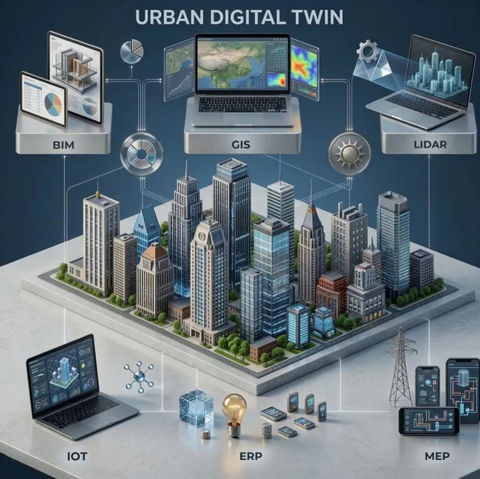
Everyone wants the cool visual. Almost no one does the integration work. Here's what a real Urban Digital Twin actually requires — layer by layer.
There's a phrase that gets thrown around in infrastructure circles as if it were easy: "just connect the data." But anyone who's actually tried to build a functioning Urban Digital Twin knows the truth — integration is where projects go to die.
It's not a technology problem. The sensors exist. The platforms exist. The data exists. The problem is that nobody can agree on what it means to reconcile six fundamentally different data worlds into a single, coherent operating system for a city.
You aren't "plugging things in." You are reconciling different data schemas, update frequencies, and levels of detail — all at once.
The six layers every urban digital twin needs
A properly architected Urban Digital Twin is a stack of six interdependent layers. Skip one, and the whole system loses its predictive power. Here's what each one does and why it matters:
Building Information Modeling
The architectural blueprint — every wall, pipe, beam, and specification encoded as structured data.
Geographic Information System
Places the building in the world — topography, infrastructure networks, land use, spatial relationships.
Light Detection & Ranging
Real-world point clouds that validate what was built against what was designed, continuously.
Internet of Things
Live sensor feeds — temperature, occupancy, energy, movement — the nervous system of the twin.
Enterprise Resource Planning
Operations and maintenance workflows — work orders, procurement, asset lifecycle management.
Mechanical, Electrical & Plumbing
The technical systems that make buildings functional — modeled, monitored, and maintainable.
What "integrated" actually means
Most teams get stuck at the dashboard phase. They wire up a few IoT sensors, pull some GIS data, drop it into a 3D visualization, and call it a Digital Twin. It looks impressive in a boardroom. It's operationally useless.
A real Unified Data Environment is different. The layers don't just coexist — they actively trigger each other. Consider this chain:
That chain — from a sensor reading to a maintenance team dispatched with the right specs, via the right route — is what a Digital Twin is actually supposed to do. No human in the loop. No manual cross-referencing. No lost context between systems.
Building that requires solving hard problems at every integration point. BIM and GIS use different spatial reference systems. IoT data arrives in milliseconds; BIM updates might happen quarterly. LIDAR point clouds contain billions of data points that need to be semantically matched to BIM elements. ERP systems speak in work order logic, not geometry.
The goal is not a cool visual. The goal is a Unified Data Environment where a sensor trip in the IoT layer triggers a work order in the ERP, based on specs in the BIM.
The honest question to ask your team
Before you start the next Digital Twin initiative, forget the platform selection and the 3D rendering engine. Ask a simpler question: which of these six layers is your biggest bottleneck?
Is your BIM data incomplete or not maintained after handover? Is your IoT infrastructure piecemeal, with five different protocols and no unified data broker? Does your ERP have no API surface, making integration a custom nightmare every time?
The answer tells you where to invest first — and it's almost never in the visualization layer. The intelligence lives in the integration. Everything else is just a window into it.
Urban Digital Twins represent one of the most complex data integration challenges in modern infrastructure. The six-layer architecture — BIM, GIS, LIDAR, IoT, ERP, MEP — isn't a checklist, it's an interdependent system. Get the plumbing right before you build the dashboard.